HORNCASTLE

Historic background
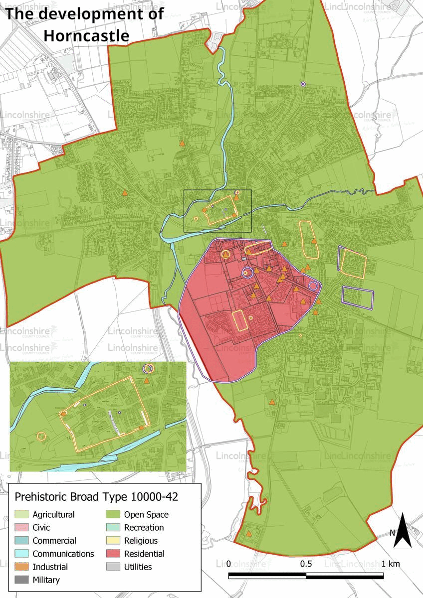
Evidence of human activity is recorded within the survey area from as early as the Mesolithic period and finds of Neolithic and Bronze Age date include artefacts which indicate land management. The earliest evidence for actual settlement within the town dates to the Iron Age, initially located to the south of the town centre. This area appears to have been occupied from the late Iron Age, with settlement continuing into the Roman period and enduring for much of the period. Evidence of settlement, cemeteries and industry is recorded demonstrating a continued occupation of the area. A walled enclosure was constructed in the late Roman period, to the north of the earlier settlement within a projection of land created by the confluence of the rivers Bain and Waring. Its use during this period is unknown, although the site became the dominant settlement site in the following centuries and forms the town centre in the present day. Sections of this walled enclosure are still visible across the town centre and parts of it have been reused in later buildings.

Settlement continued in Horncastle in the early medieval period, although the nature and extent of occupation is largely unknown. A small number of scattered artefacts from the period confirm local activity and by the Domesday survey of 1086, Horncastle was a large settlement and head of a soke which stretched from the Wolds to the Fens, with areas of cultivated agriculture, small holdings and a royal manor. In the medieval period, the town remained concentrated within the older Roman walled enclosure, and a limited amount of development along West Street, the Bull Ring and North Street took place outside of this area. In the 13th century, Horncastle was given formal permission to hold a market and fair. In later centuries it became one of the most well-known horse fairs in the country. This event created several subsidiary trades such as tanning and leather working. Public houses also proliferated in the town, catering for visitors of the fairs. Agriculture was a major driver of the town’s economy throughout the medieval period and the surrounding area was largely organised as part of the open-field system, with areas with common rights in the fen, and meadow along the rivers. The town saw a period of growth during the 18th and 19th centuries, stimulated by the construction of new turnpike roads, a canal and the railway. New parts of the town’s periphery were released for development by the passing of a Parliamentary Act which enclosed the agricultural land surrounding the town. The new growth following the Act is visible to the east and south of the town centre as terraced streets with areas of industry or public amenities were constructed for the growing population. During the modern period, the town has expanded residentially, with large new developments on all sides of the town. The canal and railway are no longer in use, although evidence of the canal is seen across the town centre. Over the course of the 20th century, cars became the dominant form of transport which resulted in the construction of the inner relief road A158, also known as Jubilee Way which has cut across the promontory created by the rivers

Character Summary
The character of HUCA 1 is a traditional market centre, with a variety of buildings which span the period from the 16th to the 19th century. The town centre is largely concentrated within the Roman walled enclosure, which has dictated the form of later development. The dominant building material is red brick, although some have been built in stone and a small number are rendered. The town centre buildings are 2-4 storeys and create a narrow streetscape with a sense of enclosure. The River Bain crosses to the north of the market place and across Bridge Street creating an open break in the urban space. The street form creates a small number of central roads which contain shops, banks and public houses. The 19th century expansion of the town is visible in HUCA 2. This character area demonstrates the character of development largely from the 19th century. Comprising areas of terraced streets, industry and public buildings, this area is like HUCA 1 although the buildings are less dense and show more planned elements rather than ad hoc construction. The modern development of the town is captured in character areas 3 and 4.
These HUCAs demonstrate many types of housing construction which reflect national building styles rather than local character, although later 21st century development has begun to take inspiration from the town centre. New areas of industry were also established in these HUCAs as it moved away from the town centre to the periphery of the town. The agricultural land remaining within the parish is represented by HUCA 5. Much of this land retains a good level of character gained after the parliamentary enclosure of the area in the early-mid 19th century, although some of this pattern has been removed with the advent of modern farming.