HYKEHAM

Historic background
Remains from the prehistoric period are recorded across the area. These largely relate to scattered finds including hand axes, flint tools and a quern stone. These finds provide an indication of the possible ways in which the local population was interacting with the environment during this period. An increased amount of occupation remains are recorded from the Roman period. A Roman villa is known to the south of the Fosse Way and further potential settlements are also recorded across the area. Other domestic remains and the possible remains of iron working industry are also recorded, although further investigation is required to confirm this. The Fosse Way Roman road crosses the survey area. There would have been constant activity along the road from this period, and it would have been a prominent feature in the landscape.
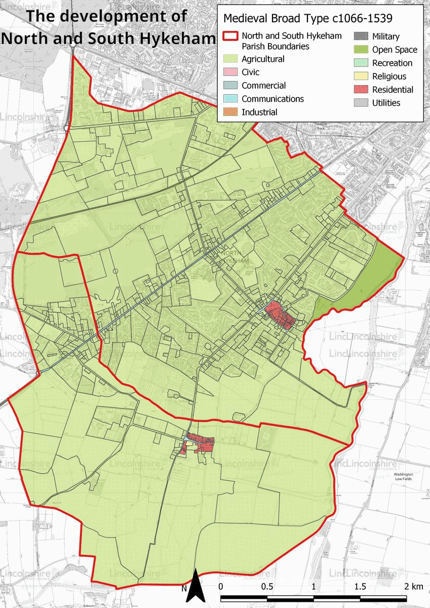
The later settlements of North and South Hykeham were both established in the early medieval period and are mentioned in the Domesday survey of 1086. In this survey, they are shown to contain a small number of families, arable and meadow. A church was extant in South Hykeham from the 13th century and excavations on the site indicate that there may have been an earlier church on the site. North Hykeham had a chapel from the 12th century. Consequently, North and South Hykeham were known for a time as Chapel Hykeham and Church Hykeham respectively. The settlements were agricultural from the medieval to the modern period, which is supported by several areas of ridge-and-furrow identified in the survey area. South Hykeham has remained a small agricultural village.
In the 19th century a railway line was constructed across the agricultural landscape of North Hykeham to Lincoln. The area surrounding the station became a small hub for industry which has endured ever since. In the modern period, North Hykeham was residentially developed; its undeveloped space and proximity to Lincoln provided an ideal area for large residential estates. These developments have created large areas of unbroken residential areas. Industry has also expanded in the area in the modern period with gravel quarries and out of town business parks. In the later 20th century the quarries have been converted into recreational lakes or redeveloped for new industrial uses.


Character summary
The character of North and South Hykeham is varied. North Hykeham has developed due to the specific needs of the major local population centre of Lincoln. Its former medieval core, HUCA 2 is still discernible despite having been absorbed into the urban extent of the area. This area is characterised by a mixture of post-medieval farmsteads and modern housing. It is formed around a probable medieval road system which once connected to a chapel, at the south-western end of Chapel Road. The residential extent of the area is defined in HUCA 3 and 4. These character areas are characterised by large scale residential developments, which included schools and local amenities from the mid 20th century to the present day. HUCA 3 represents the earlier developments of the 1960s, which has a more uniform residential character comprising semi-detached and bungalow housing, which reflect design elements from the period. HUCA 4 demonstrates the design styles of the late 20th and early 21st centuries, with a wider variety of buildings and an irregular road pattern.
North Hykeham has also seen rapid industrial and commercial growth in the late 20th century, which has covered a large amount of the parish and is recorded in HUCA 5. This area comprises lakes, which are the remains of former quarrying activities and large business parks. The lakes are now recreational spaces and nature reserves. The business parks are made up of large commercial units with associated parking. Large infrastructural industry is operational in the area such as the Energy From Waste plant which can be seen from many points in the wider landscape. South Hykeham is recorded in HUCA 1. Its medieval core has remained relatively intact since this period and comprises a crossroad of country lanes next to a central church. This church has been extant since the 13th century, although a structure was present on the site before this. The buildings in the character area comprise post-medieval farmsteads and modern housing, although the more recent development has largely reflected the historic character of the settlement. The agricultural area which surrounds South Hykeham is recorded in HUCA 6. Characterised by arable land, this area is divided by internal hedgerows and dykes. The limestone cliff which crosses the county from north to south rises to the east of the survey area and creates a visual backdrop to HUCA 6.