MABLETHORPE / SUTTON ON SEA
Historic background
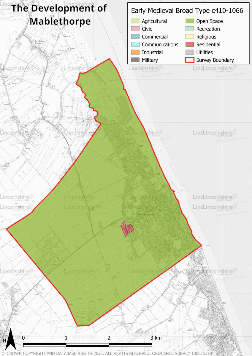
Prehistoric and Roman archaeological evidence in the survey area is sparce. Added to this is the fact that much of it is unstratified due to the historic and on-going coastal erosion. It is possible that there was a Roman salt-production industry in and around Mablethorpe as in other parts of the Lincolnshire coast, however there is no evidence for this. The earliest record of Mablethorpe as a settlement is in the Domesday Survey of 1086, meaning it existed from the early medieval period. The origin of the name derives from the personal name “Malbert” and the place name “Thorpe”, which denotes a small settlement dependent on a larger one. In the medieval period Mablethorpe was divided in two parishes, Mablethorpe St Peter’s and Mablethorpe St Mary’s. The church of the former was lost to coastal erosion while the latter’s church location was changed so as to avoid this outcome. It was relocated in the 14th century and is the current St Mary’s Church. The land was mostly privately owned and used for crops and grazing.


There is evidence of two possible medieval settlements off the A1031 which were abandoned at some point during their history. The survey area was mainly agricultural in the post-medieval period until the 19th century when Mablethorpe began to expand. The arrival of the railway to Louth in 1848 and to Mablethorpe in 1877 saw tourism and investment in the town. This expanded Mablethorpe’s urban area and increased its population, the main motor of this growth being tourism. During the 20th and 21st centuries Mablethorpe has continued to expand to the north and south of the High Street. In the 20th century there was an increase in recreational facilities, such as cinemas and amusements, due to the increased importance of tourism. Towards the end of the 20th century the number of caravan parks and camp sites increased, which occupy large areas of land.
Character Summary
Mablethorpe has five Historic Urban Character Areas, each of which represent distinct characters and phases of the town’s development. HUCA 1 represents the agricultural land of the survey area, it includes most of the western part of the survey area. It mainly consists of private agricultural enclosures and 19th century farmsteads with some camp sites, caravan parks and a water park. HUCA 2 represents the coastal area, it is mainly characterised by large open spaces, mainly sand dunes and beach. It is also the location of the majority of the town’s coastal recreational facilities as well as 19th and 20th century housing. HUCA 3 represents the High Street and 19th century expansion. It includes the medieval listed church of St Mary and two 17th century listed cottages. However, the majority of the buildings are from the 19th and 20th centuries. They represent the town’s urban expansion particularly in the late 19th and early 20th century.

The High Street is also the commercial centre of the town. HUCA 4 represents the 20th and 21st century expansion to the north and south of the High Street. This area is mainly residential but also includes many civic buildings, a park and outdoor sport areas. HUCA 5 represents the bulk of the caravan parks and camp sites in Mablethorpe. These were mainly developed in the late 20th century and in the 21st century. They are located to the northern and southern limits of the town and are mainly for summer recreational use.