SPALDING
Historic Background
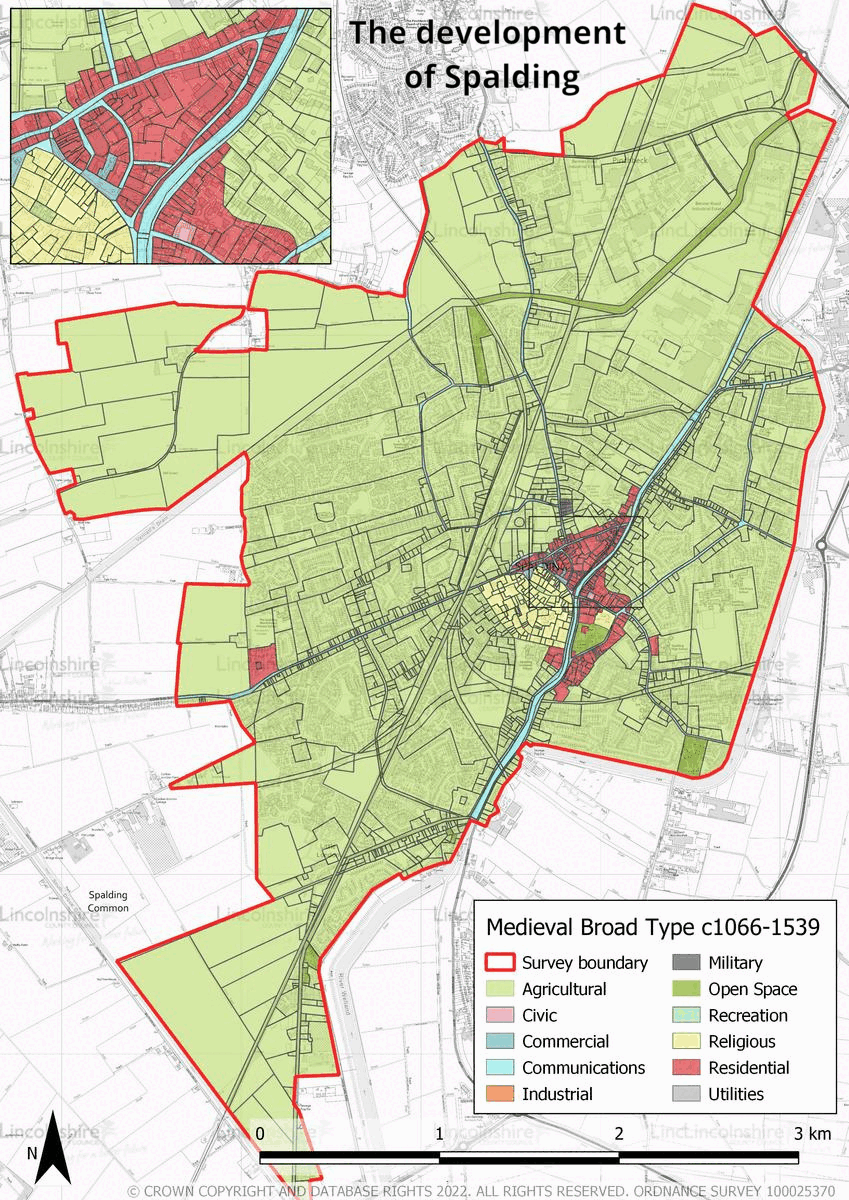
Settlement is recorded in the area from the Iron Age, although local activity was occurring earlier. Evidence of farmsteads, iron working and salt-production are seen particularly across the west and south of the survey area from the late Iron Age onwards, and appears to have spread north in the early-medieval and medieval period. Land and water management infrastructure is also seen across the late prehistoric to Roman periods with the construction of large ditches. One of the most well known during the Roman period—the Westlode also probably served as a mode of navigation from this time. In the early medieval period, a settlement is known to have been extant in Spalding, as confirmed by charters from the 8th and 9th centuries, although much of the land was used agriculturally or for wetland resources such as reeds or seasonal grazing. In 1051, Spalding Priory was founded in the triangular area of land formed by the former route of the Westlode and the River Welland. In the Domesday survey, three separate estates are recorded in the town, possibly located in three distinct areas, to the north of the Westlode, in the angle created by the confluence of the Westlode and the River Welland, and to the east of the River Welland. Spalding priory owned a lot of land in the area, and the priory enclosure covered a large area in what is now the town centre of Spalding from Wensover Road in the west, St Thomas’ Road towards Spalding Grammar School in the south, the River Welland in the east and the market place in the north. The wealth of the priory funded new buildings in the town such as the St Mary and St Nicholas’ Church. Spalding also became one of the wealthiest river ports in the Lincolnshire Fens, its wealth generated from its status as entrepôt for towns including Stamford, Peterborough and Bourne.


In the beginning of the post-medieval period the Priory of Spalding was dissolved, which along with other factors, saw a decline in the prosperity of the town. The success of the port from the 18th century saw a revival in the town’s fortunes. The town’s focus shifted during this period as many new industries were established along the River Welland alongside new houses. By the end of the 19th century, the river trade had started to decline as a new focus had been established in the town with the construction of the Spalding Railway. This connected the town to many destinations allowing local goods to be transported with ease. Its construction also coincided with improved agricultural production, facilitated by the large-scale enclosing and draining of the surrounding fenland. New steam powered pumps also increased agricultural productivity, by allowing water to be pumped away effectively. In the late 19th century, a slight agricultural depression saw the increase in other industries such as the production of flower bulbs. This industry grew steadily over the 20th century, and peaking in the 1970s. The 20th century also saw the urban extent of the town grow exponentially on all sides, new residential developments, schools and industry being the main types of development. This period also saw the decline of the railway in favor of road networks and the introduction of extensive road improvements, the most recent being the Spalding Relief Road which is being constructed to the west of the town.
Character Summary
The character of Spalding is varied; HUCA 1 is a quintessential market centre with buildings predominantly dating from the post-medieval period, although the layout is largely medieval. The riverside has a very strong character which is captured in HUCA 2. The area is predominantly Georgian in architectural style and was largely developed in the 18th and 19th centuries. The River Welland forms the focus of the character area and the majority of the buildings face towards it. Ayscoughfee Hall, the Church of St Mary and St Nicholas, and the surrounding residential development form HUCA 3, the buildings in the character area face to the river, although they are set back from the road. The architecture ranges from the medieval church and hall through to modern office buildings, however the character created between the heritage assets in the medieval and early post-medieval periods is still highly legible. The introduction of the railway changed the direction of growth in the town and it began to spread towards the west. This area, identified in HUCA 4, is characterised by Victorian and Edwardian development, comprising a large amount of residential development and industry, built as businesses sought to establish themselves close to the station. HUCA 5 and HUCA 6 comprise the large-scale modern development which has taken place over the 20th century. These developments are largely brick built and largely reflect the style which was prevalent at the time of construction. The layout invariably includes large roads with estates connected by winding through-roads with cul-de-sacs. Schools have been developed as part of the larger developments and are present frequently across the area. A large industrial area, located to the north of town, is identified in HUCA 7. This area began with the sugarbeet factory in the early 20th century and has grown since that time. It is characterised by large industrial buildings, generally constructed from metal and brick with associated amenity areas for parking and loading; chimneys in the area can be seen from much of the surrounding area. HUCA 8 represents the remaining agricultural land in the parish. The character of the landscape is largely flat arable land with frequent large ditches, used for drainage. Some of these are medieval or post-medieval in date and have been utilised for an extended period. There is limited tree or hedge cover as the ditches form the boundaries.