STAMFORD
Historic Background
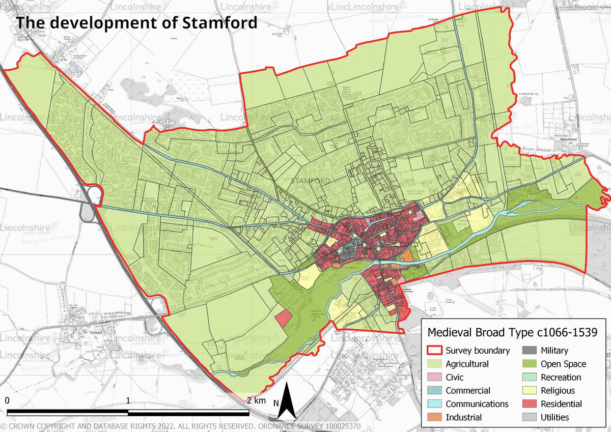
Stamford’s development has been affected by multiple factors including its location, topography, geology as well as human factors, which have been influencing its change since before the 9th century. Stamford’s geographical location on the lowest crossing place over the River Welland has made it into an ideal area for settlement and there has been occupation within the survey boundary since the prehistoric period. There are a number of heritage features relating to this period within the survey area, the majority of which are findspots. Flint tools from the Palaeolithic, Mesolithic periods as well as axes from the Neolithic and Bronze Age have been discovered within the survey area. Evidence of settlement is seen from the Iron Age period and occupation is recorded both to the south and north of the River Welland and on the western slope of the River Gwash. Excavation of these sites indicate that occupation continued into the Roman period. The origins of what became the later town of Stamford began in what has since become the town centre during the early-medieval period. Initially a Saxon settlement was established, probably to the north-west of the town, followed by a Danish burh in the 9th century, from which the town centre’s layout partially originated. The town began to grow into an economically successful settlement in the 9th century with the establishment of multiple industries including pottery and fabric manufacturing, both of which endured as highly successful trades into the middle of the medieval period. In 918 a second Saxon burh was established to the south of the River Welland by Edward the Elder, to whose rule both sides then submitted themselves.


The character of Stamford’s core dates to the medieval and post-medieval periods and was formed by a variety of factors. In the medieval period, Stamford was divided into multiple parishes, hence the numerous churches. These stone built churches are a common feature on street corners across the town and their spires can be seen from across Stamford and the surrounding area. During the medieval period religious houses, public institutions and large merchant’s halls were also established in large numbers, many of which are still extant. Consequently the layout of the early town, which consists of modular areas of development divided by irregular roads has been well preserved. A large amount of redevelopment took place in the 17th, 18th and 19th centuries following a period of economic decline. Consequently, the town reflects a mixture of medieval and Georgian/ Victorian architecture. Lord Exeter of Burghley House had a huge impact on the town in the post-medieval period, influencing many decisions regarding its design and restricting or promoting development. The modern period has witnessed the clearance of some older residential areas in the town centre and the development of suburbs in their place, although the town centre has a good level of preservation. This is partially credited to the establishment of the UK’s first Conservation Area in 1967, and to the decisions of major local landowners in the earlier period. In the late 20th and early 21st centuries, Stamford has increasingly become a tourist attraction.


Character Summary
The town contains a small number of distinct character areas. Topographically, the town slopes towards the River Welland providing views from both sides towards the other. The town centre, separated by the River Welland is part of HUCA 1. This area is the present day commercial heart of the town and also contains the largest portion of the town’s heritage assets, a well preserved built environment and historic street layout. Local stone is used across the area, due to its proximity to the town and this has given Stamford a built form which is rare within Lincolnshire. Modern retail parks and light industry are recorded in HUCA 2. This development is a feature which was once common within town centres, although it is more often found in purpose-built areas on the edge of towns in the modern period. Consequently, the main character of HUCA 2 is fairly indistinct with large shopping units and associated parking and small local industries. In the early–mid 20th century, Stamford Council built large new housing estates for the growing town and the residents who had been displaced by clearances in the town centre. This housing, as well as additional 20th century development, is recorded in HUCA 3, which is predominantly residential alongside some public buildings such as schools. Although the council built a large number of houses in the town over the 20th century, some private development also occurred which is recorded in HUCA 4. This HUCA was developed piecemeal through numerous private ventures which has created a highly varied architectural character. HUCA 5 was residentially developed in the latter part of the 20th and the early 21st centuries. It is reflective of architectural styles common at time of construction.