WRAGBY
Historic background
Archaeological remains from the prehistoric period are well known in the hinterland of Wragby, including the Lincolnshire Wolds to the east. Find spots and scattered remains from the Neolithic and Bronze Age indicate that activities such as hunting were likely taking place during these periods. The probable remains of a domestic Iron Age farmstead are recorded to the north-east of the town centre. Associated finds included bone fragments from domesticated animals as well as burnt cereal remains, which suggest that food production was taking place. To the west of this, high-status probable Roman settlement remain is documented. Hypocaust tile, tesserae, painted wall plaster and building material suggest the structure was probably a villa with under floor heating, painted walls and a mosaic. The domestic pottery assemblage recovered from the site includes high value imported Spanish amphora sherds. Further Roman remains are recorded following recent archaeological investigation to the east of Wragby town centre, which has included tile kilns confirming the presence of industrial activity during this period.


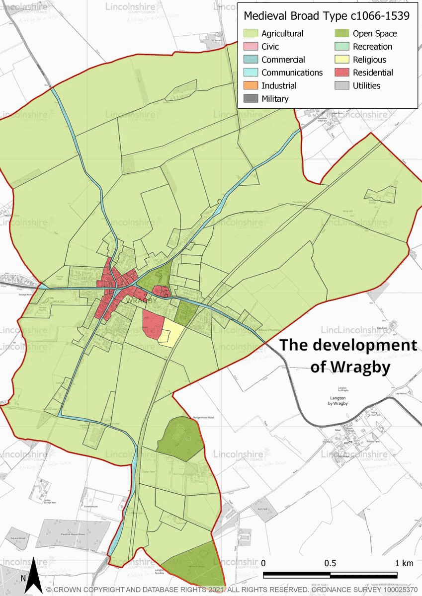
Wragby had two manorial estates by 1086. The Domesday survey documents the change in the ownership of the two estates from Countess Judith and Guthfrithr in 1066 to Erneis of Buron and Waldin the Artificer following the conquest. Erneis owned the larger estate which included a church and a priest. The remains of his moated manor house and church are preserved to the south-east of the present day town centre of Wragby and is a scheduled monument (NHLE: 1016967). It is likely that Waldin’s estate dwelling was closer to the town centre where the later settlement developed. Documentary evidence records that the first market was established by royal charter in 1221. This was held at the former manor of Erneis of Buron, which at this point was owned by William de Ros, located to the south-east of the town centre. By 1285, permission was granted for the market to be held in the village market place rather than at the manor. It is probable that the market centre became the economic heart of the village as the entire settlement shifted to the centre of Wragby between the 15th and 16th century. Wragby has not seen a large amount of change since the medieval period, and its layout is still focussed around the market place. Many of the town centre buildings were renovated in the post-medieval period, particularly in the late 18th and early 19th centuries.
Despite these renovations the market layout and street pattern has remained largely unchanged, and many of the buildings were likely constructed on the same footprint. The main industry in Wragby throughout its history has been agriculture. During the medieval periods the surrounding landscape was managed under an open field system. In the post-medieval period, the landscape was enclosed, transforming the field-scape into smaller hedged land parcels. In the 19th century, Wragby was connected to the railway network and sheds were constructed to store the goods, including cattle and grain, prior to departure. In the 20th century, the landscape was modernised and many of the former enclosed fields were amalgamated into large fields, more suitable for modern farming techniques. The town also diversified into other industries including plastic production. In the late 20th and early 21st centuries, the town has experienced a small amount of population growth with a number of small housing estates erected along the main roads. Despite this development, Wragby has remained a small market town and has retained a large amount of its historic assets.
Character summary
Wragby has been divided into five character areas. These include the historic core, which focusses on the historic market centre. The historic core is easily recognisable as a town centre due to the presence of the crossroads, which is a busy junction connecting to Lincoln in the west, Louth and Horncastle in the east, Market Rasen in the north, and Bardney in the south. It is surrounded by post-medieval buildings, many with Georgian and Victorian architectural styles and a wide market place, which is a recognisable aspect of many market towns across Lincolnshire. Over the course of the 20th century, residential development was carried out in small housing estates and its design followed national housing trends. The houses are set back from the street and the inclusion of driveways reflects the changing requirements of new homes during this period. Modern housing developments of the 21st century are more sympathetic to the red brick and pantile market character which is found in the town centre. The houses are set close to the road and are purposefully varied to give the impression of ad-hoc construction which has taken place over time rather than in one development. Traditional street furniture also compliments the historic character of the town centre. Modern civic buildings, including the town hall and Wragby Primary School have been developed to the north-east of the town centre, in an area of former parkland. A small number of post-medieval houses are extant within the character area. Residential development has taken place, not as estates but as ribbon development along Louth Road. Surrounding Wragby, the landscape in the present day is agricultural, gently undulating with large modern fields which are bounded by hedgerows and field trees. The former moated manor site is also located within the character area and is recognisable as a raised mound in the landscape.