KIRTON IN LINDSEY


Historic Background
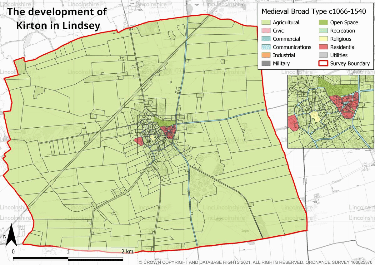
Archaeological evidence of the prehistoric activity within the survey area is extensive. Remains of activity from the Mesolithic through to the Iron Age include flint tools, crop marks, funeral monuments and settlement evidence. These provide a great amount of context for how the landscape was managed and occupied over an extended period. The area is also crossed by the course of a known prehistoric routeway–the Jurassic Way, which connected much of North Lincolnshire. There are a number of Roman occupation sites in the area, including one villa of national importance, which is indicative of a high status settlement. A Roman domestic settlement recorded in the town centre has been documented alongside Anglo-Saxon remains, which suggests that the site was occupied almost continuously throughout these periods. It is likely that Kirton in Lindsey was established as a settlement in the early medieval period. The placename Kirton in Lindsey is suggestive of the presence of an early church and archaeological remains, including a 5th-7th century cemetery (although this is just outside of the survey area) demonstrate the presence of local, organised communities. The earliest masonry in the church of St Andrew dates to the 11th century. By the Domesday survey of 1086, Kirton in Lindsey was well established with large areas of agricultural land, meadow and a settled population. The manor, which was owned directly by King William I, possessed a large area of soke land in the wider region making it an important administrative centre during this period. In the medieval period, the manor which is likely to have been located on Manor Farm or within the moated area, south-west of the church, was used as a royal asset which could be granted for favour. In 1377, it became part of the estate owned by the Duchy of Cornwall. A market in Kirton was first granted in the 13th century, and a market place was also founded during this period. Located on the east of the town, its establishment created a polyfocal settlement.

Surrounding the town, the open field agricultural system was utilised and the landscape was characterised by large fields with little internal division. Arable land was generally located to the east of the town closer to the limestone ridge and pasture or meadow was focussed to the west in the areas of lower ground. In the late 18th century, this landscape underwent a process of enclosure following the Parliamentary Enclosure Act of 1793. This transformed the landscape from an open area to one of smaller fields divided by hedges. The town had an agricultural focus with much of its economy driven by this industry and those which supported it. The 18th century was a period of change with the construction of large new public buildings including the Manor Court house and Bridewell Prison. In 1799, the manor and its estates were divided and sold by the Duchy of Cornwall. As an open parish (one without the leadership of one lord), local landowners were able to have greater control over development in the town. This encouraged the settlement in the town of labourers from outside of Kirton in Lindsey resulting in a much higher population growth than many of the surrounding towns. By the mid-late 19th century, this growth had slowed. The town was connected to the railway in 1849 which encouraged the growth of local industries, some of which were located adjacent to the new station. In the 20th century, the town has grown slowly. Development has taken place across the area, the centre has seen infilling with residential housing and in the late 20th century new stand-alone developments have also been completed and development is increasing in the early 21st century.
Character Summary
The character of Kirton in Lindsey is varied with structures and plan forms from different periods recognisable across the parish. Building materials vary between local limestone and brick, many buildings also show a combination of both. HUCA 1 is the high density medieval market centre of the town. This area has a large number of post-medieval public buildings including the Manor Court House and town hall. Historically it was the economic centre for the town with a market place. HUCA 2 also has origins in the early medieval/medieval period with small irregular road pattern/enclosures surrounding the 11th century church. In the 19th and 20th centuries these irregular enclosures were in-filled with housing, although the layout of the road pattern remained largely unchanged. Further 20th century development has taken place on the periphery of the town centre, represented by HUCA 3.
These largely date to the late 20th and early 21st centuries and are residential in nature with some schools and parks included in the developments. HUCA 4 is characterised by a short-term development which is associated with the Second World War. The RAF base and associated structures including residential housing and amenities developed separately to the town and is of a different character, reflecting the requirements of the base. HUCA 5 represents the 19th century railway station and 20th century light industry area of Kirton in Lindsey. Following the introduction of the railway, several small light industries have established themselves in this area, creating a concentration for businesses and trades in the town. HUCA 6 represents the agricultural land in the parish. This is characterised by both post-medieval and modern field patterns with a hedged and divided landscape across the limestone ridge and on its eastern and western slopes.